Bali: resort development on farmland put on hold after major floods
Bali Governor Wayan Koster announced a moratorium on farmland conversion to tourist and commercial use. Every year, about 1,000 hectares of rice paddies and green spaces are lost, with extensive damages to the island’s traditional irrigation system. According to the Environment Ministry, only 3 per cent of the Ayung River Basin is still covered by forest, far from the minimum standard of 30 per cent.
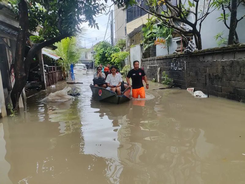
Denpasar (AsiaNews) – A few days after devastating floods killed 18 people with dozens missing on the Indonesian island of Bali, new legislative measures have been proposed to curb the conversion of farmland and natural areas into commercial and residential properties.
The island, which remains in a state of emergency while relief efforts continue, has lost an average of 1,000 hectares of agricultural land annually in recent years to villas, hotels, and resorts, local sources report.
"Starting this year, [. . .] there will be no further conversion of productive land for commercial purposes, such as hotels, restaurants,” said Governor Koster during a meeting to coordinate flood management in Bali last Sunday.
During the event, Environment Minister Hanif Faisol Nurofiq noted that the damage to Bali's Ayung River basin was already severe, stressing that only about 1,500 hectares out of a total area of 49,500 hectares, or 3 per cent, remains covered by forest. Yet, environmental standards require that at least 30 per cent of the basin area should be forested, Hanif explained.
For his part, Governor Wayan Koster tried to be reassuring, stating that tourism in Bali remains safe despite the recent floods. The average number of foreign tourists arriving in Bali is still around 21,000-22,000 per day.
Tourism has had the greatest impact on land use and green space reduction, putting at risk the Subak, a Balinese irrigation system listed as a UNESCO World Heritage Site.
This system has regulated the island's social, religious, and economic life for centuries, harmonising the use of water resources between the dry season and monsoon rains, preventing floods and droughts.
Making matters worse, megaprojects like the Gilimanuk-Mengwi toll road, threatens 480.54 hectares of rice paddies and 98 Subak sites, this according to experts.
For land-use planning expert I Nyoman Gede Maha Putra, the issue is not just about land conversion, but also about the type of infrastructure built on it.
“When the government says land conversion isn’t the cause, it’s not entirely wrong. But it’s also not entirely correct. Land conversion is one of the contributing factors to flooding,” he explained.
Green areas, especially rice paddies and forests, act as natural sponges, absorbing rainwater, thus reducing runoff into rivers and preventing flooding.
“After handling the floods, we will meet again to ensure no more permits are issued for hotels, restaurants, or other facilities on productive land, especially rice fields,” the island's governor reiterated.
The new rules are consistent with another moratorium, proposed in October 2024, which included a two-year ban on the construction of tourist and commercial facilities in Badung and Tabanan (which lost 6 per cent of their rice-growing surface), as well as Denpasar and Gianyar.

.png)
04/07/2019 16:44
16/12/2024 18:08